|
|
|
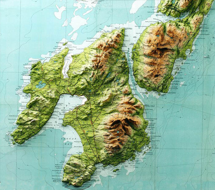
This map shows clearly the rugged, rocky features of Islay and Jura.
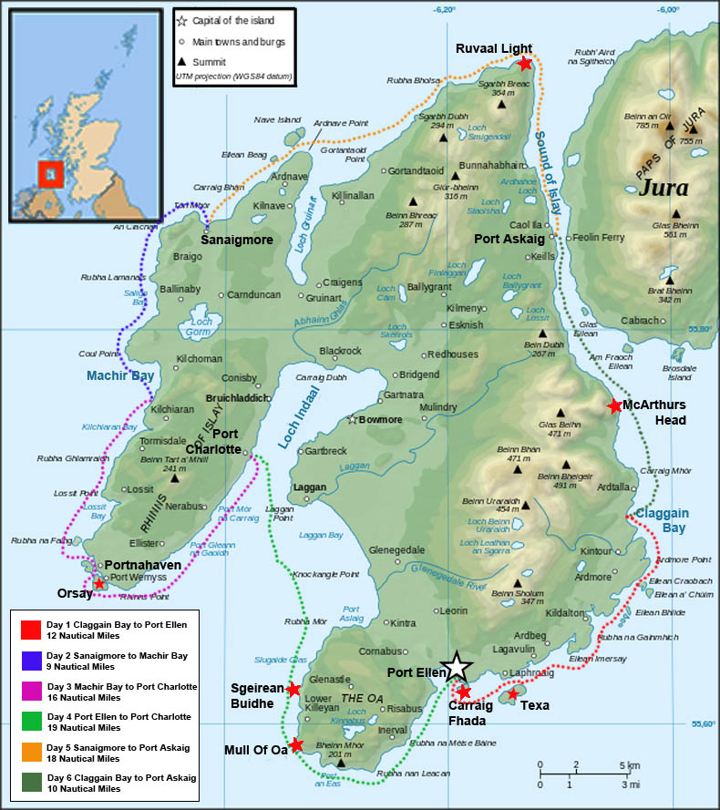
Circumnavigating Islay
It was only on my third visit to Islay (pronounced "Eye-lah") that I actually stood on a road or went into a building. Several years ago, whilst paddling around Jura, Islay's wilder neighbour, we spent a night on a remote beach on the east coast. My other visit was even shorter: We nipped across from Jura for lunch on another remote beach before heading back across the Sound of Islay, to camp on Jura.
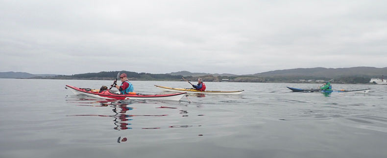
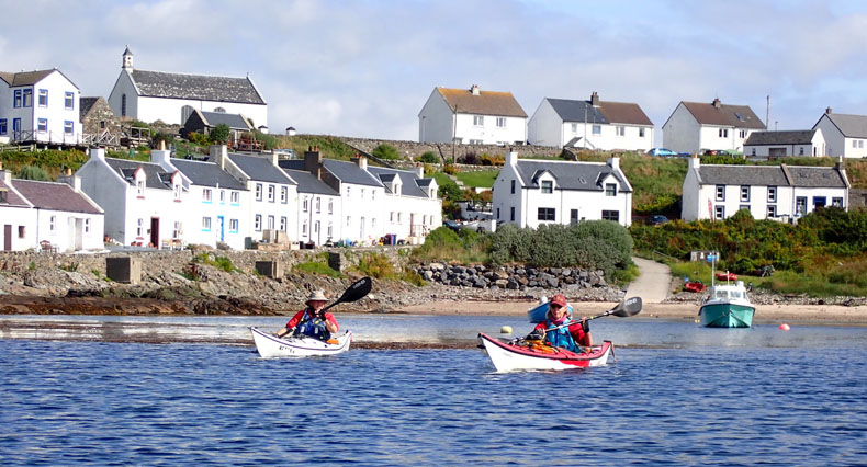
Paddling through the islets of the south east corner. A flat calm day and a perfect introduction to paddling on Islay. Day 1 — Claggain Bay to Port Ellen 12 Nautical Miles
Our first day was along a sheltered stretch of the southeast coast. We explored numerous offshore islets complete with amazing wildlife. Hundreds of seals, mainly harbour but some greys, to illustrate the difference in size. A White Tailed Eagle watched us for a while before majestically flying off. Over the week we were on the island I recorded 70 different species of birds and this wasn't the prime birding season.
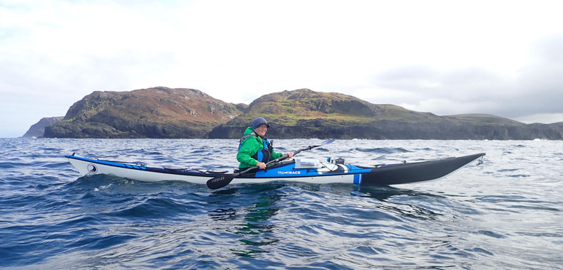
Nicky paddling around the north west coast. We had been pushed offshore by the swell so missed out exploring some amazing geographical features. Day 2 — Sanaigmore to Machir Bay 9 Nautical Miles
This was just a short day as we were getting the feel for Islay, which I was surprised to find is the eighth largest island in the British Isles. As a trained geographer I just love facts like that.
The second day we decided to paddle the north west corner, which in hindsight was probably a mistake. There was a residual North Atlantic swell running, which meant that it wasn't always possible to approach the complex coastline. The occasional exploding wave (boomer) kept us on our toes but we did manage to find a delightfully sheltered beach for lunch. There were two possible landing places, the first had about six feet of surf rolling, whilst slightly to the south, a mile long sweep of sand had about three feet of surf breaking. No prizes for guessing where we landed.
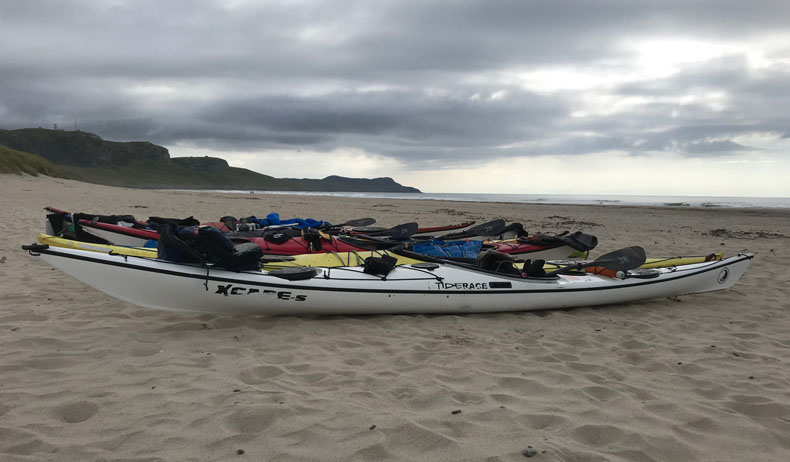
Machir Bay on the west coast. I had a great 30 minutes surfing the day before and it felt remote enough that we were happy to leave our equipment overnight. Day 3 — Machir Bay to Port Charlotte 16 Nautical Miles
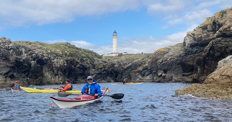
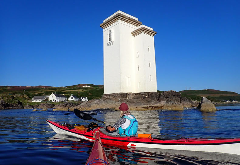
The following morning we returned to Machir Bay, re-united with our kit and finding that the swell had dropped off over night, we jumped on the south going tide, aiming for the small village of Portnahaven. On spring tides or with strong winds the south west corner of Islay is a significant challenge. Tidal streams of eight knots, heavy overfalls and the North Atlantic swell combining to create some "interesting" waters. On this sunny Tuesday the conditions couldn't have been more benign. Portnahaven was a delightful spot to stop for a pretty dreadful cup of coffee. From there we wandered out to Orsay, to look at its lighthouse, which was built in 1825. It is one of four lighthouses on Islay built by Robert Stevenson, the grandfather of famous author, Robert Louis Stevenson. Besides building the lighthouses, "His many innovations included his choice of light sources and mountings, his reflector design, his use of Fresnel lenses, and his use of rotation and shuttering systems that provided lighthouses with individual signatures — allowing them to be identified by seafarers [Wikipedia]."
Rhinns of Islay lighthouse on the small island of Orsay. Built is 1825 by Robert Stevenson. One of many Stevenson lighthouses around the coast of Britain.
Angus and Janet paddling out from the pretty village of Portnahaven. An ideal place to stop when waiting for the tidal window to continue the journey. Tidal streams reach eight knots in this area. Day 4 — Port Ellen to Port Charlotte 19 Nautical Miles
There are some days on the water which remain etched in the memory and Wednesday was one of those. As we pushed off the beach in Port Ellen, little did I realise that it was going to be one of my best days paddling ever. The aim was to paddle around the Mull of Oa, before heading north to Port Charlotte. From the beginning the scenery was dramatic, set against stunning blue seas and sky.
Carraig Fhada lighthouse Port Ellen. The first significant feature on one of the most memorable days we have ever had on the water.
Approaching the headland of Sgeirean Buidhe. The rocks taking on a distinctly reddish hue. The Jura Quartzite, which is the main rock in this area, has been stained by iron oxides and various manganese minerals.
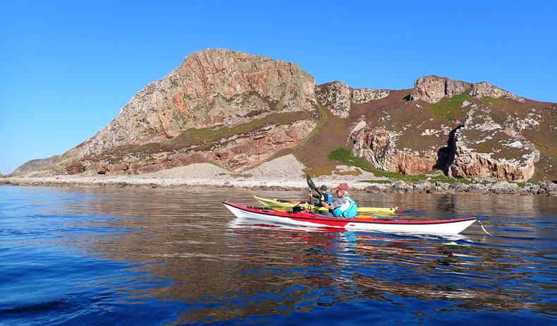
Nicky off the Mull of Oa. The American Monument is visible several hundred feet above the water.
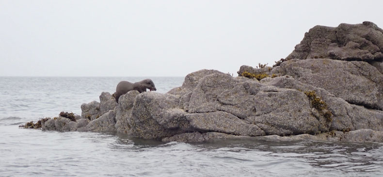
A sea otter hauls out on the rocks to snack on some fish.
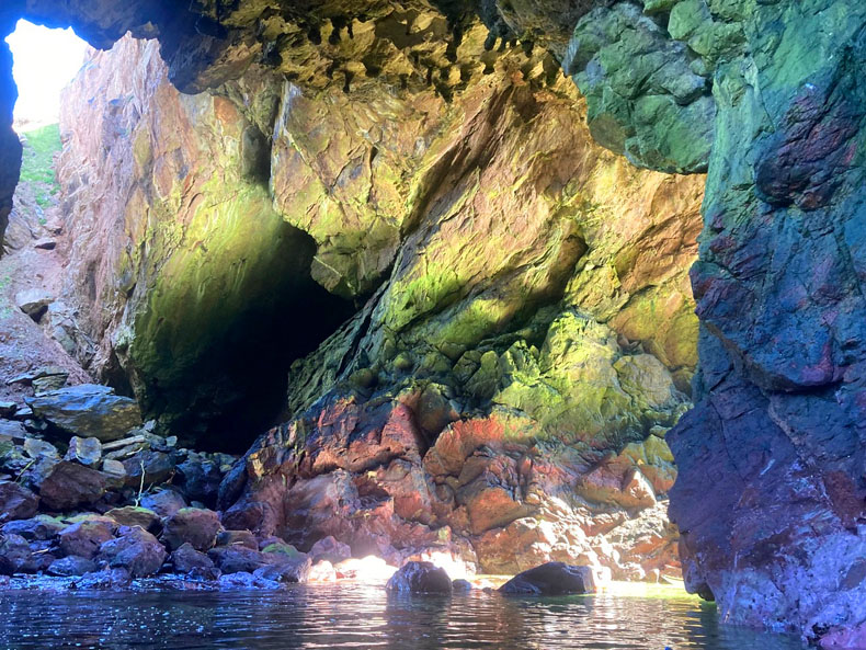
Sun reflections prismed into some amazing colours are to be found inside the caves and arches.
On this memorable paddle we were accompanied by quite a large pod of bottlenose dolphins, for probably 20 minutes, plus a few otters and numerous seals along the shore. Overhead there were the inevitable eagles, of the White Tailed variety.
It is the scenery that remains clear in my mind though, a reflection of the complex geology found in this area. Some of the rocks had a distinctly reddish hue due to the fact that the quartzite has been stained by iron oxides and various manganese minerals. The whole area is a physical geographers dream with numerous caves, arches and stacks, with the features taking on a unique perspective from the cockpit of my Nordkapp.
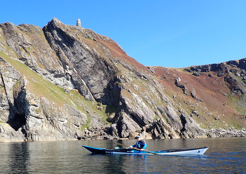
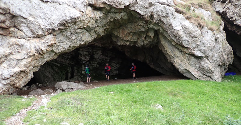
Raised caves and arches on the north coast. The path is the result of goats walking into this area. Access on foot is really challenging with numerous miles to be walked across boggy terrain with no footpaths. Day 5 — Sanaigmore to Port Askaig 18 Nautical Miles
Thursday was potentially the most committing. It was pretty much the whole of the north coast plus a portion of the Sound of Islay. 18 nautical miles in total, with only one possible exit point after 16 miles.
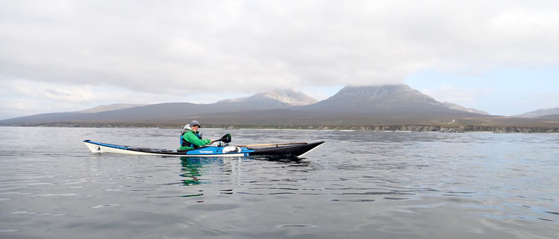
Nicky paddling south in the Sound of Islay. The Paps of Jura are visible behind. They are a really wild walking area. This was where we reached ten knots, as the tidal streams pushed us south.
The north east corner of Islay is marked by another Stevenson lighthouse, Ruvaal, after which the paddling became quite interesting. We entered the Sound of Islay, at the start of the ebb tide, and immediately started to feel the impact of the current. Five nautical miles just flew past, with some hard sprinting we managed speeds of just over ten knots, all set against the dramatic backdrop of the Paps of Jura.
Day 6 — Claggain Bay to Port Askaig 10 Nautical Miles The final day was going to be an easy ten miles along the sheltered east coast. Just make sure that we went with the tide and within three hours the circumnavigation was complete.
McArthurs Head Lighthouse on the east coast of Islay. Our last day on the water, along a stretch of coast ten miles long with no road access.
My initial calculations required 72 NM of paddling to circumnavigate this Scottish island, which is closer to Belfast than to Glasgow. I thought four days of paddling 18 NM would see us round. I also thought who gets four flat calm days in this area in September? The reality was 84 NM in six days. It could have been farther if conditions and time had allowed us to explore in greater detail.
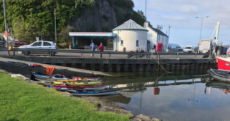
Landing at Port Askaig at the end of our circumnavigation. The kayaks resting on the beach whilst we had our celebratory pint on the lawn of the hotel.
|
|
|