|
|
Five Days, Five Paddles in the Adirondacks
By Tamsin Venn. Photos by Tamsin Venn and David Eden.
|
|
|
We toss a coin. Forked Lake or Blue Mountain Lake. It is tails Ė Forked Lake it is. This kind of flippant decision making can be part of the paddling experience in the Adirondacks in upper state New York. So many possibilities Ė lake, pond, river, brook, flow, portage, loop, out and back Ė allow for low risk adventures. Any choice is a good one.
We are on our annual trip in August with the Rhode Island Canoe and Kayak Club (RICKA), where a group of paddlers, ranging from ten to 20 people, bonded by paddling experience in Rhode Island waters, shift north for a week of paddling in the water wonderland here. The trip is well organized by Henry Dziadosz and Chuck Horbert. Dziadosz was a Boy Scout leader for many years so he knows how to keep a group together. This year there are enough participants that Henry and Chuck decide to split the group and lead separate paddles on most days.
Base camp is the Lake Eaton state campground, just outside the village of Long Lake. We all try to make our reservations for sites nine months in advance. Our group gathers each morning at 8:30 or 9 then caravans anywhere from 15 to 50 minutes to a launch site. At the end of the day everyone returns to their own camp site already set up, hot showers. There is usually a group campfire gathering after dinner for tall tales and Símores.
Forked Lake
|
|
|
|
|
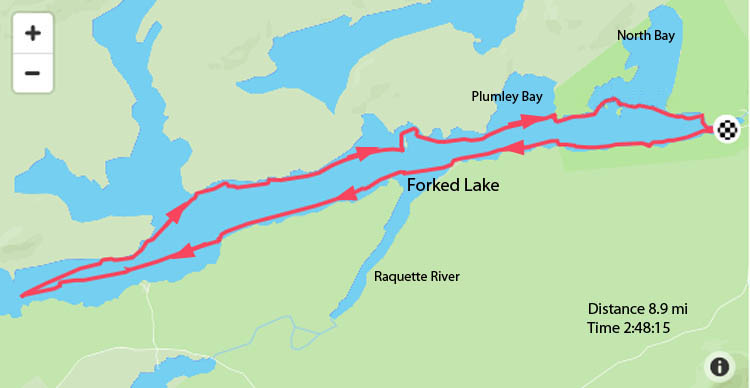
Forked (pronounced FORK-ed) is only seven miles southwest of Long Lake. You take Route 30 to the sharp turn off for Buttermilk Falls on the Raquette River, follow a paved road past the falls, then a gravel road to a large parking area, access area, and rangerís hut.
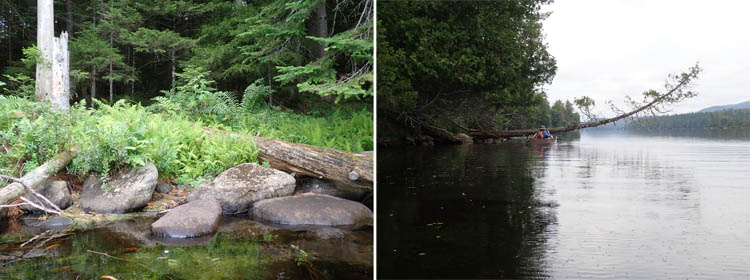
Staying close in gives a more intimate sense of the lake and offers both lovely long views and shoreline jewels.
At Forked Lake State Campground, lots of people rent aluminum canoes to go out to one of the nearby campsites, 80 in all, dispersed along the shore and islands, near the put in. Amidst a carpet of pine needles and canopy of cedar, the campsites are equipped with fire ring, pit toilet, and a steel bear box, clipped on with chains (no keys necessary), some have lean tos, several have rough docks. Cost is $23 a day for out of staters. The lake also sees a lot of day use.
David and I are here without the rest of the group. They had paddled the lake while we were still driving from Ipswich, and we had already paddled the Bog River. (RICKA is flexible about splitting off.) The ranger tells us there would either be a thunderstorm in an hour or at 4:00 p.m. Anxiously we set off, hoping itís the latter. The skies are smudged in gray clouds but nothing really dangerously black-looking and no thunderheads. We have gotten used to being in the Adirondacks with predictions of thunderstorms and have learned to live with it. They can be very localized, so key is to follow the radar.
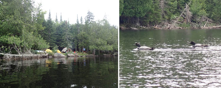
L: A typical camp site along the shore. R: A large lake like Forked will support several pairs of loons.
Forked is a seven-mile-long narrow lake shaped like an inverted T, hence the name, with two islands. The narrowness makes for an intimate feels and draws you down to the west end. (We do not explore the northern T section.) We follow the shoreline to the end of the campsites at which point private land is posted with No Trespassing signs. Once we pass beyond the camping sites, the boat traffic dies considerably.
A few motorboats ply the water, nothing too big or noisy, and mostly we pass others in canoes or kayaks, many are fishing. The shoreline is lined by cone-shaped cedars and smooth boulders, some branches overhang creating reflections in the still water, like a Japanese watercolor. Several groups of loons allow us a close look at their ebony necks and white spotted backs, a living tuxedo with red eyes, dipping to moisten their eyes. We see two buzzards, some fish jumping, and a beaver crossing to the other side. Some young kids, possibly Mennonites, are fishing from canoes at the end of the lake.
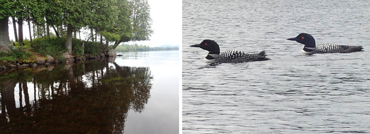
L:The path on the left leads to an illicit campsite and fire ring. R: Another of the several pairs of loons we saw.
At the lakeís end, a boggy swamp signals turn-around point, and we follow the other shoreline back. We stop at site 80 for lunch along Plumley Bay (Plumley Pond sits behind), at a shaded picnic table. Getting out on the dock is a little tricky from the Hornbeck canoes but doable, if you donít mind splaying yourself flat on the dock, twisting up, while trying to hold onto the boat with a foot or a hand. Milly, our Jack Russell terrier, is happy to get out of the boat for some sniffing and exploring. After lunch, we start heading back to the launch, just poking our bows into the other fork of the lake. We make it back after a four-hour, 8.93-mile out and back, just as the rain starts. We think wow perfect timing, but then the rain stops, as the variable weather does here in summer.
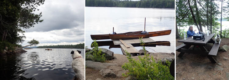
L: Milly watches anxiously as David turns a corner. Mid: The basic float and dock access at our lunch spot. R: It's always nice to lunch at a table.
Itís $8 for a day parking pass, free for seniors 65 and over Monday through Friday. Check in at the ranger station. If heís out on the water in his motorboat checking campsites, he will soon be back, the sign reads.
Blue Mountain Lake
|
|
|
|
|
Today, more thunderstorms and showers are predicted throughout the day, but as ever, life must go on, so we decide on Blue Mountain Lake, never having paddled there before. It is not really a group friendly option due to parking limitations (side of the road next to the town beach) and tiny launch area. The group is going to the Raquette River, which we have done several times so thought we would try something new.
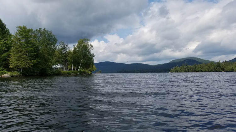
The skies promised both torrential rain and lovely sun. We got both, sometimes at the same time.
On Rock Pond, I had met a fellow training for the Ninety-Miler, a three-day paddling race through the Adirondacks in early September Ė itís a grueling 30 miles a day. He suggests his training route as a good option, for the type of paddling we like to do, move from lake to lake via short carries. The farther out you go on the carries, the friendlier the people.
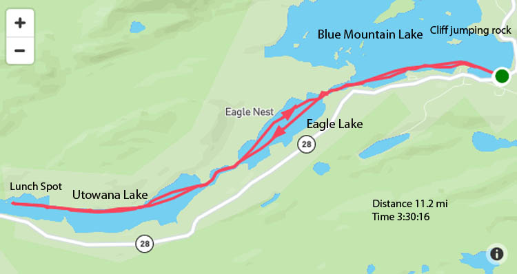
This fellow leaves a car at Blue Mountain Lake, his wife drops him off at Raquette Lake, and he paddles the 12 miles back to Blue Mountain Lake via Raquette Lake, the Marion River, Utowana Lake, Eagle Lake, and finally Blue Mountain Lake, a total 12 miles miles. We would do it in reverse
We put in at Blue Mountain Lake at the public access next to the public beach (look for the lifeguard chair across from the fire station). Skies are threatening, but patches of blue here and there look promising. The lake is very busy with all types of craft. We turn left, follow the south shore of Blue Mountain Lake for 1.5 miles to Eagle Lake, marked by the red and green buoys. Entertainment is provided by teenagers who have hauled their kayaks up a nearly vertical rock island, then run and jump out into the water about 18 feet down and scramble back up. Then they do it again. And again. Ah youth.
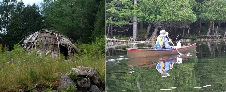
L: The shores of these lakes may once have been lined with similar wigwams. R: Paddling the river sections between the lakes was a totally different vibe.
We follow a tree-shaded, no-name stream (a section of the Marion River perhaps) into Eagle, a beautiful narrow lake with few houses. It is lively with waves beyond the protection of the arched bridge. An older kayaker comes along and says, OK, what are your plans? Then he chastises us for not having brought a raincoat for the dog, as the heavens open up and huge droplets bounce off the black water. We hope it doesnít turn into hail. The only rain clouds surrounding us hover square over Eagle Lake. We can see sunny skies over the mountains on both sides of us. But after a half hour, the deluge dissipates, due to wind or mountain interactions, and we are paddling into a mere cloudy day with occasional spitting. Milly is happier.
Eagle Nest Great Camp is situated on the north shore of Eagle Lake on its own 2,000 acres, available for rent for family reunions. At the boat house a phalanx of Adirondack chairs line the deck, waiting the noisy crowd that can be heard above in the house.
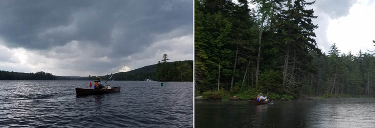
L: The worst weather hit us on Eagle Lake. R: By the time we hit the last river segment into Utowana, the rain had lessened considerably.
Our attention is diverted, though, by a mother loon ferrying a baby on its back, our first view ever of this enchanting behavior. It tolerates us, and the frat party, rather well.
We enter our third lake, Utowana, two miles long and change, via a short boggy stream. Both lakes are ringed by private property, so no getting out to stretch. We head to what is marked as a lean to or campsite on the map at the west end of the lake on a short wedge of public land. That expands northward to Sargent Ponds Wild Forest and the remote Sargent Ponds. Just beyond the lean to, is the 992-meter portage to the Marion River, which leads you to Raquette Lake. You can hear the sound of trucks on Route 28, belying the sense wilderness. The road is very close to the shore, although it is completely hidden behind a screen of trees.
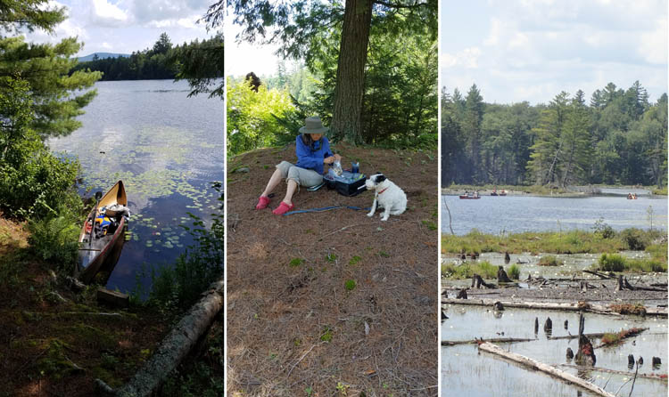
We had sun and nice breezes for lunch. Milly had a good stretch. The trees across the lake from our knoll hid Rt. 28, but you could hear the roar of traffic. We spotted several canoes coming out of the Marion River, probably all the way from the town of Raquette Lake.
We find an inviting clear hillock carpeted by dry pine needle with a fire ring, on an island just short of the leanto but still on public land. We are relieved to stretch after 5.8 miles of paddling and watch a number of canoes coming out of the Marion River. Milly is overjoyed to run free and disappears into the blueberry bushes and scrub. It is a gorgeous site for lunch. Our contentment is complete as the sun comes out, the day warms up, and we begin to steam dry.
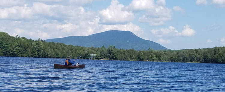
Back on Eagle Lake, heading home. We had fairly strong tail winds all the way back, which led to some serious weathercocking.
We try to check out if they have taxis in Raquette Lake so we can just paddle the rest of the way there, another six miles, and get shuttled back to Blue Mountain Lake, but get no signal on the phones so we must turn around and retrace our route. The rewards are several: strong wind pushing us swiftly back; sighting of a bald eagle and kingfisher; and cloud shadows shifting across the flanks of Blue Mountain hovering over the lake.
Blue Mountain Lake is a score and well worth the strong headwinds and torrential rains that spiced up our morning. It has a free launch, convenient parking on the street, a public restroom, and sheltered swimming area at the beach. Plus it has several public islands, definitely worth exploring next time.
Polliwog Loop
|
|
|
|
|
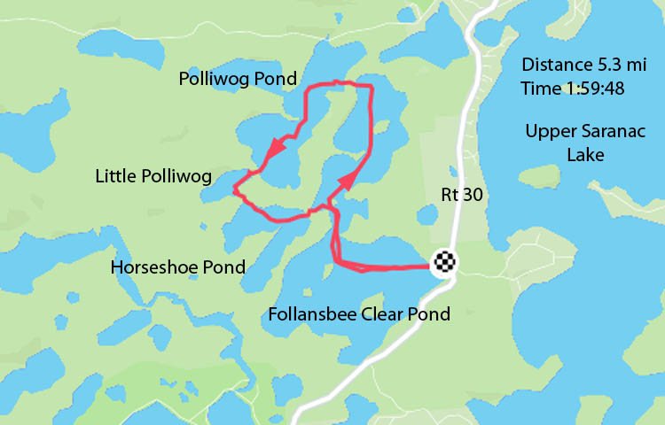
Today we rejoin RICKA to head north to the Fish Ponds area, to do the Polliwog Pond Loop. This is a protected, round-trip circuit of four ponds with four portages that can be run in either direction. None of us have done the trip before so we are relying on leaders Chuck and Cindy Horbertís map-reading to find the way.
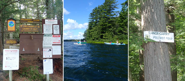
L: Launch next to Rt 30. Mid: Follansbee Clear Pond R: The carry signs, though kept up, are small and hard to see from a distance.
The portages seem easy in terms of distance, all less than .25 miles. As it turns out, several have steep segments. Although Adirondack guidebook author Dave Cilley says the portages are not wheelable, several of us use wheels with a lot of bouncing involved, due to exposed roots from much use. Those with lighter plastic kayaks just drag them along the ground, no rocks.

L to R: Polliwog Pond. The carry to Little Polliwog. Little Polliwog in its entirety.
More problematical is finding the portages, which our leaders do with great skill, and occasional help from other paddlers we run into. The portages are well marked with signs, but you have to find them first. It helps to have binoculars. Look for well trodden paths among the hanging branches.
Launching at the put in at Follansbee Clear Pond Access, just off Route 30, 1.75 miles south of Floodwood Road, we head west across the pond, paddling into a strong wind, past a few islands, and turn almost due north, around a peninsula to the northwest corner of the lake where the carry is located. The carry from Follansbee into Polliwog Pond is the tripís longest portage at 600 feet, and is quite steep both up and down. We travel south down Polliwog Pond, about ĺ mile long, and not more than a few hundred yards wide. It has a shape like a squished together S. Half way along Polliwogís bottom southwest shore we carry over into Little Polliwog Pond. We have lunch at the top of the carry, a nice open spot with moss and pine needles, a trail passing through. We carry downhill to Little Polliwog Pond, which is tiny, and joke that the pond is shorter than the carry. Little Polliwog is about ľ mile long and 100 yards wide.
About half way along the southeast shore is the carry into Horseshoe Pond. A paddle along the north shore of Horseshoe Pond, brings us to the carry at the northeastern tip back into Follansbee Clear Pond. This is the shortest and muddiest carry, and one of our trip members has a leech attach itself (leeches are actually a sign of clear water). She is very calm as she removes it.

The four ponds give a variety of paddling experiences. Together with the carries, it makes for a rich Adirondack experience.
Back on Follansbee we turn right to the south and come out the narrows into open water and very strong winds, back to the put in.
Follansbee has a lot of boats including several small motorboats, plus several parties of canoeists and kayakers. It can be tough paddling when the wind comes up because it is so wide. But when you drop into the smaller ponds they are small and scenic and invite lingering.

Various portage scenes. RICKA president Pat Lardner adds a spot of color to the carry. You have to admire the folks that schleppd the inflatable and its motor all the way out here. And when we got back to camp, we found Smokey Bear!
We see and hear several loons, including two very small babies. We learn later from the ranger that it has been a difficult year for loons because of high water flooding earlier in the summer on the marshy shorelines where the loons tend to nest. The birds canít walk well on land so they like to nest on the edge, where they can launch into the water. The eggs get cold from the flooded water and donít hatch. The chicks we see are small because the parents had renested. It is questionable whether they were going to make it, the ranger says.
Middle Saranac Lake
|
|
|
|
|
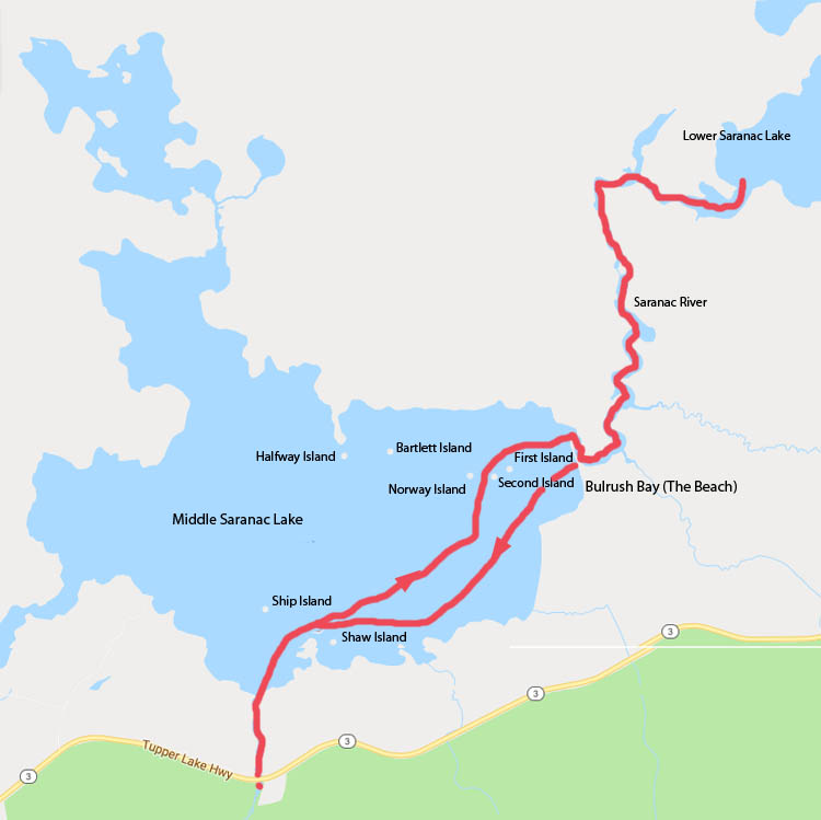
Middle Saranac Lake to the Upper Locks is one of RICKAís favorite trips along with the Bog River Flow. We put in on the public access point on Route 3, which puts you onto to the southern shore of Middle Saranac via a winding, marshy stream. Route 3 borders the High Peaks Wilderness area so you see some peaks here off in the distance. Fortunately a big boulder right off the end of the creek makes the stream easy to find on the way back.
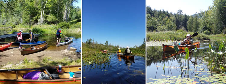
L: Launch next to Rt 3. Mid-R: The stream out to the lake.
Today is beach day, Henry promises, but first a trip to the Upper Locks. We skirt the southern shore, pass several islands with inviting looking campgrounds. We enter Bull Rush Bay at the eastern end then the Saranac River (follow the buoys). The river twists and turns, mergansers and ducks scoot along.
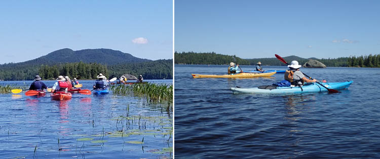
L: Entering the lake. R: The large rock marking the stream access, very helpful on our return.
At the Upper Locks, the lockkeeper is present to help us out, but operating instructions are posted if no one is there. If one of your party does this, someone has to hang onto the lone boat tightly in the lock as water surges in as you rise and fall creating a washing machine. Our boats take up the whole lock, which is very fun, as we hang onto each other. The alternative is a scratchy 2 + rapids the right of the lock.
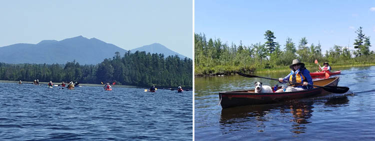
L: Paddling into Bulrush Bay. R: On the Saranac River segment.
On the downstream side, you follow the Saranac River into Lower Saranac Lake, well worth a look before turning around, filled as it is with many beautiful islands, many with camping spots. Kelly Slough, a quiet little bay, is also an option.

Into the Lower Locks.
We paddle back through the locks, this time having to wait our turn, and have lunch on a beach in Bull Rush Bay, then paddle south farther along the beach with more clear access from bull rushes, and go for a proper swim, although you have to wade out fairly far. Many people are picnicking here. We then make our way back along the southern shore to the aforementioned boulder. Itís a long day at ten plus miles but worth every moment.
Round Lake
|
|
|
|
|
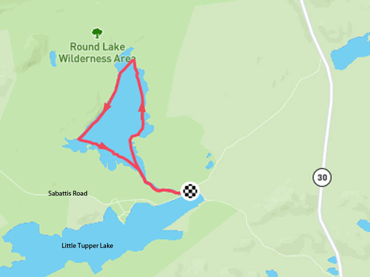
We did Round Lake last year, but it is definitely worth a return trip. Next to Little Tupper Lake and tucked away into the William C. Whitney Wilderness Area, the 740-acre Round Lake is a quiet gem that sees little other paddling traffic. Motorized vehicles are prohibited. Round Lake is actually a triangle, and to make it around the lake is about a seven-mile trip. We clocked 6.9 miles in three hours and 22 minutes, including lunch and swimming.
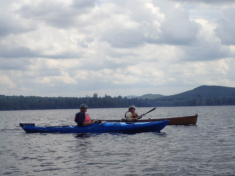
Out on Round Lake.
A small, boggy access point puts you into a pleasantly meandering stream, good for wetland bird watching, then into the lake itself. We follow the east shore to a long beach at the northern end, which has a convenient thunderbox (an outhouse without walls or a roof). To swim you go out beyond the logs and plants and swim back and forth along the shore, the water temperature is ideal. As we leave a group of pre-teen boys in three canoes and their leader arrive for lunch. The leader is still smiling and cheerful, so they couldnít have been out for too long. David douses a smoldering fire at a campsite. Who leaves a campsite that way?
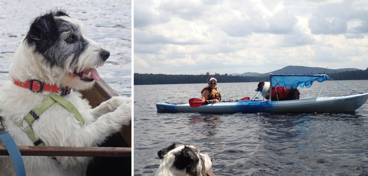
Milly always takes a lot of interest in what's going on, in this case, Pat Lardner and her doggie barge.
After lunch we take off into strong headwinds, gusting higher, but the western shore provides a lee. Here we paddle along, an eagle following us; farther on a loon family to which we give wide berth. Round Lake is also home to a unique heritage strain of brook trout known as the Little Tupper strain.
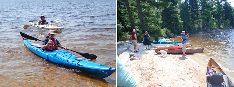
L: Heading in for lunch. R: The lunch beach on Round Lake.
Close to the put in you can paddle under the bridge to Little Tupper Lake and explore that area. Also nearby is Lake Lila, another enticing lake that is part of the Wilderness Area, which is on my bucket list. You can make the Round Lake circuit in an afternoon but many make it a day or overnight trip. It has 11 Department of Environmental Conservation campsites, first come, first served.
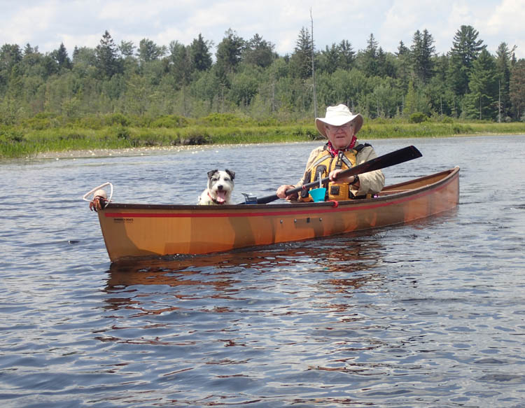
Every half hour or so, Millie demands to change boats.
David comments, ďThere is so much paddling, hundreds of miles of lakes and rivers and portages and loops. Iíve always had a thing for the Adirondacks since I got shipped off to Camp Adirondack at age five.Ē
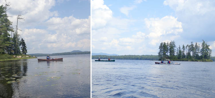
On Round Lake's southwestern shore, there are a couple of islands for visual interest.
Indeed it is like being back at summer camp. To join the fun, contact RICKA, www.ricka.org
Campground Reservation
If you plan to visit the Adirondacks and stay in a N.Y. state campground, make a reservation using https://newyorkstateparks.reserveamerica.com/. You can make a reservation nine months in advance. For the best sites (read:waterfront), do it as early as possible.
|
|


|
| | | | | | |
