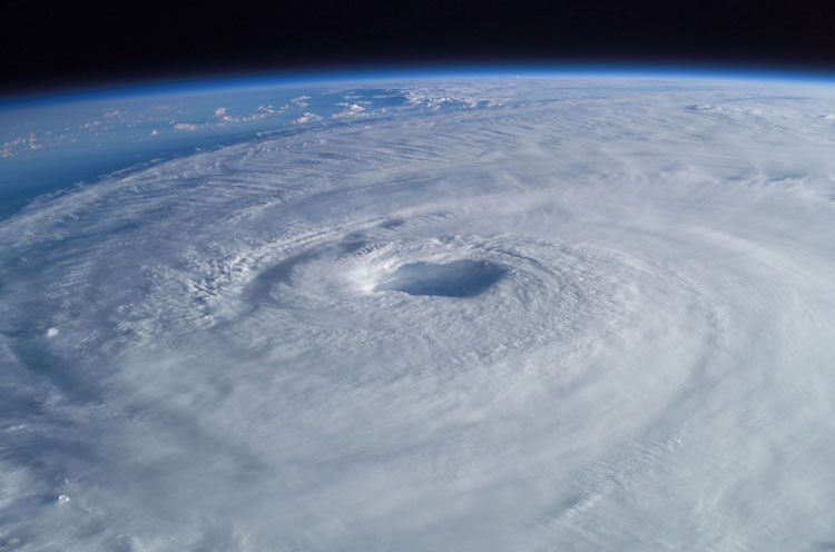
 We’ve already experienced Hurricane Elsa, the fifth Atlantic hurricane so far this season. US Harbors has provided this “cheat sheet” to help you understand the conditions/warnings/advisories that NOAA and the U.S. Coast Guard might be sharing.
EXTREME WEATHER CHEAT SHEET & QUICK LINKS
EXTREME WEATHER TRACKING RESOURCES
● Track active hurricanes & tropical storms at the National Hurricane Center
● Monitor real-time coastal flooding conditions and see 48 hour flood forecasts for your area on NOAA’s Coastal Innundation Dashboard
WEATHER ADVISORIES
“Advisories”, issued by NOAA in case of possible impending, life-threatening weather and water conditions, are classified as “Watches” (issued 48 hours before expected in your area) and “Warnings” (issued 36 hours before expected in your area.) There are generally 4 types of conditions that trigger these advisories:
● Storm Surge — When there is a danger of life-threatening inundation from rising water moving inland from the shoreline somewhere within the specified area. If you are under a storm surge warning, check for evacuation orders from your local officials.
● Hurricane — When sustained winds of 74 mph or greater are expected somewhere within the specified area. NHC issues a hurricane warning 36 hours in advance of tropical storm-force winds to give you time to complete your preparations.
● Tropical storm — When sustained winds of 39 to 73 mph are expected within your area.
● Extreme Wind — For sustained winds of a major hurricane (115 mph or greater), usually associated with the eye wall. These warnings are issued when the winds are expected to begin within an hour. Take immediate shelter in the interior portion of a well-built structure.
LOCAL, STATE, and OTHER RESOURCES
● Your local TV and radio stations, as well as area news websites, all get their weather updates from NOAA.
● NOAA broadcasts marine weather on VHF channel 22A (157.1 MHZ).
● Your state and regional office of emergency management will have local details about evacuations routes, shelters, and other important planning information.
USCG PORT CONDITIONS
The US Coast Guard sets “Hurricane Port Conditions” for major ports when weather advisories indicate sustained gale force winds of 39-54mph/34-47 knots (or above) expected in the following time frames:
● WHISKEY = Predicted to make landfall at the port within 72 hours.
● X-RAY = Predicted to make landfall at the port within 48 hours.
● YANKEE = Predicted to make landfall at the port within 24 hours.
● ZULU = Predicted to make landfall at the port within 12 hours.
Whenever USCG sets a Port Condition, they advise you to:
● Stay off the water. The Coast Guard’s search and rescue capabilities degrade as storm conditions strengthen. This means help could be delayed. Boaters should heed weather watches, warnings and small craft advisories.
● Evacuate as necessary. If mandatory evacuations are set for an area, the public should evacuate without delay. Coast Guard personnel and other emergency responders may not be able to evacuate or rescue those in danger during the storm.
● Secure belongings. Owners of large boats are urged to move their vessels to inland marinas where they will be less vulnerable to breaking free of their moorings or to sustaining damage. Trailerable boats should be pulled from the water and stored in a place that is not prone to flooding. Those who are leaving their boats in the water are reminded to remove EPIRBs and to secure life rings, lifejackets and small boats. These items, if not properly secured, can break free and require valuable search and rescue resources be diverted to ensure people are not in distress.
● Stay clear of beaches. Wave heights and currents typically increase before a storm makes landfall. Even the best swimmers can fall victim to the strong waves and rip currents caused by hurricanes. Swimmers should stay clear of beaches until local lifeguards and law enforcement officials say the water is safe.
● Be prepared. Area residents should be prepared by developing a family plan, creating a disaster supply kit, having a place to go, securing their home and having a plan for pets. Information can be found at the National Hurricane Center’s webpage.
● Stay informed. The public should monitor the progress and strength of the storm through local television, radio and Internet. Boaters can monitor its progress on VHF radio channel 16. Information can also be obtained on small craft advisories and warnings on VHF radio channel 16.
